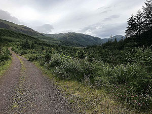
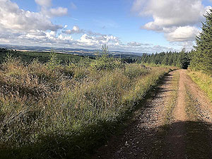
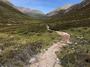
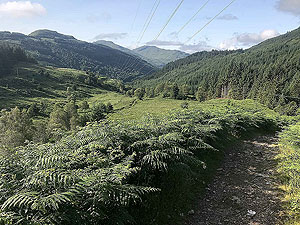
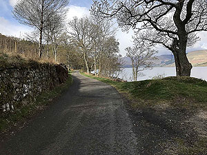
Featured Scottish running routes
Looking to browse through the available running routes ? This Features page provides summaries of the key routes on the website - enjoy.
The last update to this page was : 27th March 2026 at 06:48
Feature section
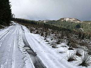
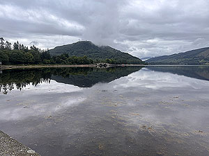
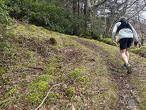
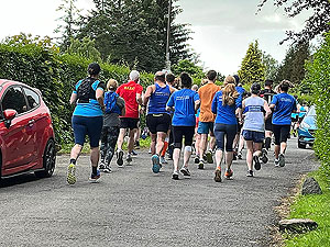
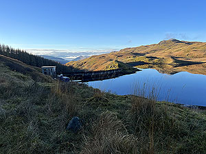
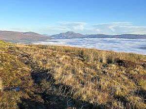
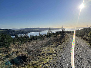
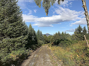
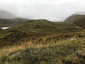
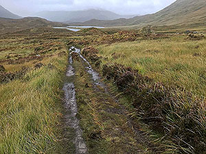
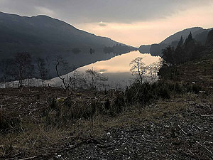
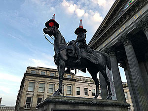
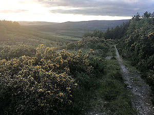
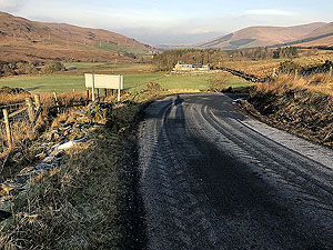
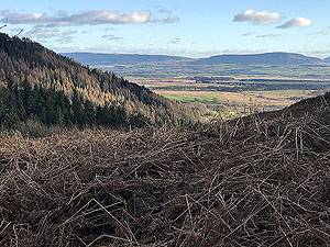
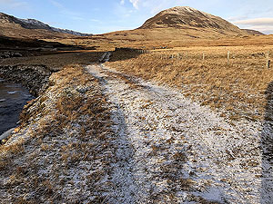
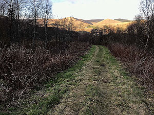
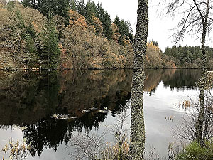
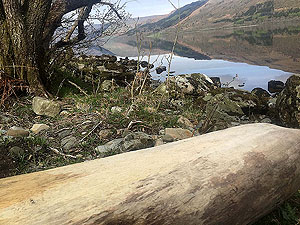
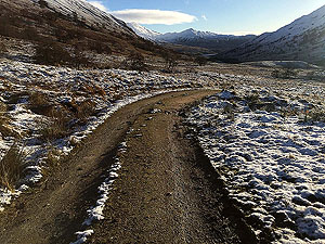
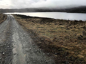
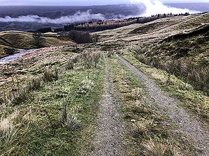
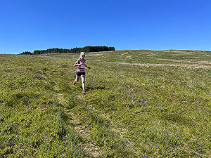
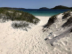
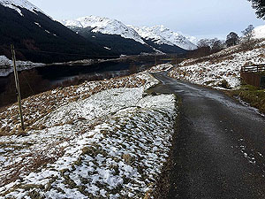
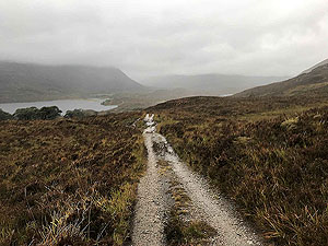
March pictures
Tap to Open
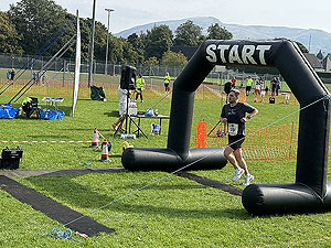
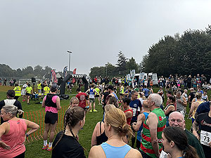
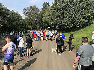
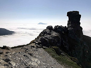
The picture set for March and a month where you can expect any kind of weather, but the temperture is generally starting to increase. Race season starts to open
up in Scotland and beyond.
The March collection of images features images taken in March from around Scotland and beyond.
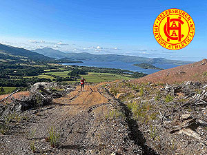
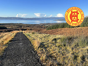
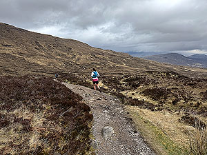
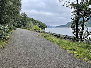
Helensburgh AAC Trails
Tap to Open
Thursday night is trail night for Helensburgh AAC. Meeting at 6:30pm in a variety of locations the runs are social and a great introduction to other members and local routes.
Come along and get your best running shoes dirty.
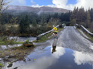
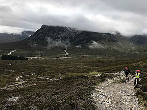
Bridge of Orchy 10k
Tap to Open
A cracking 10k on trail and tar that starts and finishes at the Bridge of Orchy .
This race is in a ghostly loop shape format covering a distance of
10 Kms
with an elevation of 217 m
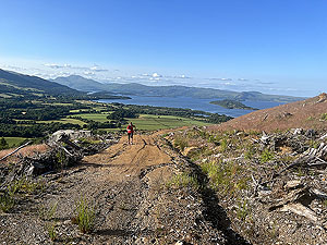
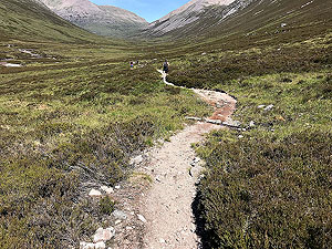
Highland Fling
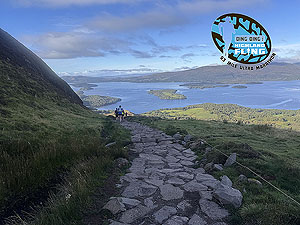
Tap to Open
An epic Scottish ultra marathon along the southern half of the West Highland Way from Milngavie to Tyndrum.
This is a point to point run covering a distance of
85 Kms
with an elevation of 2300 m
Helensburgh AAC
Tap to Open
Our first route grouping and it's dedicated to the Helensburgh Amateur Athletic Club. Discover all the races that HAAC deliver throughout the year.
Four races listed with a few hills included.
Dunoon ultra
Tap to Open
The wonderful Dunoon ultra from Benmore botanical gardens to Dunoon pier.
This race is a loop around the hills above Dunoon and is
48.9 Kms
with 1272 m
of elevation.
Glen Ample
Tap to Open
Starting on the banks of Loch Lubnaig this wonderful route takes you to the side of Loch Earn via Glen Ample.
An out and back run route giving you up to
32.2 Kms
and 925 m
of climb along the way.
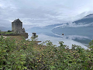
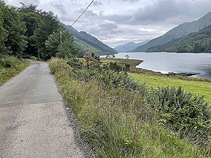
Inveraray watchtower
Tap to Open
Starting from the lovely town of Inveraray this run takes you up past the 'Green Castle' and up to the Dunn Na Cuaiche watchtower.
7.01 Kms
, mainly on trail with an elevation of
Running loop in Glenshee
Tap to Open
This is a tough hill run in Glenshee where there is no clear path for a section.
21.8 Kms
and has a total elevation gain of 769.7 m
and is in a loop format.
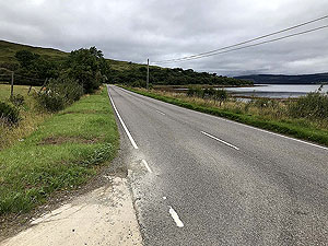
Ayrshire running from Seamill
Tap to Open
A short run on the coastal path from the Seamill Hydro up to the Hunterston power station.
10.4 Kms
with a total elevation of only 75.8 m
.
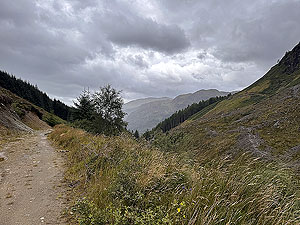
Devil o' Highlands Footrace
Tap to Open
A wonderful Ultra along the West Highland Way from Tyndrum to Fort Willaim, taking in Rannoch Moor and Glen Coe. Stunning and challenging route.
This route is
69 Kms
along mainly trail in a point to point format. There is 1981 m
of climb along the route.
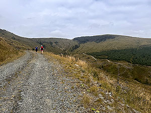
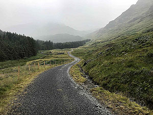
Ardgartan trail race
Tap to Open
A tough early in the year race to get your year started well. A loop on the Loch Goil penisula with lots of elevation.
This route is
34.6 Kms
along mainly forest road and trail in a loop format. There is 971 m
of climb along the route.
Islay running from Bowmore
Tap to Open
A really nice medium length run from the centre of Bowmore out onto a trail.
This route is
11.1 Kms
along mainly country road and trail in a loop format. There is 114.4 m
of climb along the route.
Path of Condie
Tap to Open
If you are looking for a tough half marathon road race then this is the one for you. Brilliant route and organisation.
This route is
21.2 Kms
along mainly country road in a loop format. There is 435 m
of climb along the route.
Bennachie hill race
Tap to Open
Tough hill race in Aberdeenshire going up and over Bennachie.
This route is
12.76 Kms
along mainly country road in a loop format. There is 527 m
of climb along the route.
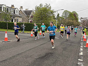
Auchterarder half marathon
Tap to Open
A not so easy road half marathon, but a great run. Well organised, as is normal from the Auchterarder running festival folks, and lovely countryside.
This route is
21 Kms
along mainly country road in a loop format. There is 236.85 m
of climb along the route.
Auchterarder 10K
Tap to Open
This 10K road race is part of the Auchterarder Running Festival and the first part of the Double Dare.
This route is
10 Kms
along mainly country road in a loop format. There is 108 m
of climb along the route.
Helensburgh Trident 10K hill race
Tap to Open
New for 2024 by Helensburgh AAC is the Trident 10K hill race. Planned for 14th September.
This route is
9.7 Kms
along trail and dirt road in a loop format. There is 381.1 m
of climb along the route.
Kilpatrick Braes
Tap to Open
A great route using the train from Kilpatrick via Loch Humphrey to Dumbarton.
This route is
13.2 Kms
along dirt road and trail in a point to point format. There is 404.4 m
of climb along the route.
Kenny Stevenson Memorial
Tap to Open
Organised by the Maryhill harriers in memory of their former member, Kenny Stevenson. Wonderful trail race in a glorious setting.
This route is
11.2 Kms
along trail and road in a loop format. There is 240 m
of climb along the route.
Whinny Hill
Tap to Open
Lovely run within and around Balloch Country Park taking in Whinny hill with great views of Loch Lomond and surrounding countryside.
This route is
11.24 Kms
along trail and road in a loop format. There is 304.9 m
of climb along the route.
Run along the Crinan canal
Tap to Open
Easy an scenic running along the tow path of the Crinan canal.
This route is
11.1 Kms
along trail and road in a loop format. There is 20 m
of climb along the route.
Trail run from Crinan
Tap to Open
Wonderful trail run from the Crinan sea loch. Some parts are tough but all the parts are so worthwhile.
This route is
8.2 Kms
along trail and road in a loop format. There is 303 m
of climb along the route.
Glen Shira to the dam
Tap to Open
A nice run in a very quiet glen in wonderful countryside. Close to Inveraray at Garron Bridge at the top of Loch Fyne.
This route is
26.7 Kms
along small country road in a out and back format. There is 337 m
of climb along the route.
Over the Carman to Helensburgh
Tap to Open
It's taken a few attempts to get good pictures of this wonderful mostly trail run. See the best of West of Scotland.
This route is
17.9 Kms
along trail and forest road and cycle track in a point to point format. There is 534.6 m
of climb along the route.
Auchterarder 10K Chilli Trail
Tap to Open
Perhaps one of the best run and best to run races in Scotland. Tough but very rewarding.
This route is
10 Kms
along trail and county road in a out and back format. There is 305 m
of climb along the route.
Trail run from Aberdeen airport
Tap to Open
If you are staying in one of the hotels beside Aberdeen airport and need a trail running route then this is for you. Within a short distance you are away from all the hassle of airport living.
This route is
13.45 Kms
along mainly trail and dirt road in a out and back format. There is 302 m
of climb along the route.
Epic trails (Glasgow)
Tap to Open
Another site with lots of wonderful routes across Scotland to try. We have a few of Nic's routes at Epic Trails on our to do list and she has also ran some of ours- a compliment indeed.
Epic trails is not just about route information as they also offer guided runs.
Great format of running information from Epic trails.
Glasgow running routes
Tap to Open
If you find yourself in Glasgow and looking for place to run then try heading over to Glasgow Running routes. Kevin has done a wonderful job in detailing all sorts of runs within and close to the city.
Another runner sharing thier love of running.
Glasgow running routes site includes city and trail runs.
Gouk hill loop
Tap to Open
A nice hill route from Duck Bay on the banks of Loch Lomond that offers just about everything for a running route.
This route is
11.52 Kms
along dirt road and trail in a loop format. There is 310 m
of climb along the route.
Beinn Dubh horseshoe loop
Tap to Open
A wonderful trail run from the village of Luss on Loch Lomond. Great views along the way with a tough climb up Beinn Dubh to start with followed by nice trail on top then a long steep downhill once past Mid Hill.
This route is
11.6 Kms
along trail and country road in a loop format. There is 581 m
of climb along the route.
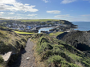
Findochty to Cullen
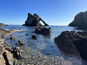
Tap to Open
A cliff run and short section of beach takes you from Findochty via Bow Fiddle rock to Cullen. Lovely part of Scotland to enjoy this short run. You might need good weather though.
This route is
9.8 Kms
along trail and country road in a out and back format. There is 206 m
of climb along the route.
Portpatrick cliff tops
Tap to Open
Lovely route along the cliff tops of Portpatrick with a little bit of climb to make it feel worthwhile.
This route is
5.1 Kms
along trail and road in a out and back format. There is 126 m
of climb along the route.
Glentress half marathon
Tap to Open
Glentress forest is close to the town of Peebles in the Scottish borders.
This is a really brilliant half marathon to do but it is not an easy one.
This route is
20.2 Kms
along trail in a loop format. There is 757.3 m
of climb along the route.
Craigendoran to Balloch
Tap to Open
Another route using railway stations as a start and end point. This one takes you up over the Ben Bouie hill from Craigendoran on the Clyde to Balloch
at Loch Lomond. Brilliant views along the way.
This route is
10.3 Kms
along trail and dirt road in a point to point format. There is 332.9 m
of climb along the route.
Roseneath Peninsula
Tap to Open
This was one of those routes that turned out to be as good as we hoped and perhaps a little better. A mixed terrain and some lovely views for almost the whole
way round.
This route is
16.7 Kms
along trail and small country road in a loop format. There is 371.9 m
of climb along the route.
Cardross to Helensburgh
Tap to Open
Our second route using the railway for the start and end of the route. This time starting in Cardross, over the hill, into Glen Fruin before a trail section into Helensburgh.
This route is
19 Kms
along trail and small country road in a point to point format. There is 474 m
of climb along the route.
Lochgoilhead to Ardentinny
Tap to Open
A long out and back going from Lochgoilhead to Ardentinny via Carrick and Carrick Castle. Small country road, forest road and trail with
lovely scenery along the way.
This route is
36.3 Kms
along trail and small country road in an out and back format. There is 479 m
of climb along the route.
Tarbet to Helensburgh
Tap to Open
A cracker of a route where we used the train stations on the West Higland line for start and end of the run. Take in some wonderful scenery and enjoy some lovely running on this
varied route.
This route is
30.7 Kms
along trail and small country road in a point to point format. There is 562.2 m
of climb along the route.
Luss to Arrochar
Tap to Open
A simple to follow out and back route using the cycle path on the west side of Loch Lomond. Lovely scenery and good quality track takes you from
Luss to Tarbet and across to Arrochar and Loch Long.
This route is
32.8 Kms
along cycle track in an out and back format. There is 302.1 m
of climb along the route.
Loch Eck
Tap to Open
A simple to follow out and back route along the west side of Loch Eck. Lovely scenery and good quality tracks all along the route making this a really
good training route.
This route is
28.8 Kms
along forest road in an out and back format. There is 366 m
of climb along the route.
Ben Bouie Loop
Tap to Open
Another route starting in Kidston Park in Helensburgh. This is a longer
distance and offers stunning views and a good amount of elevation.
This route is
24.6 Kms
along pavement, small road and trail in an loop format. There is 579.4 m
of climb along the route.
Short 3 lochs way
Tap to Open
Starting from the Kidston Park in the town of Helensburgh this route give a variety of running surfaces and some lovely views along the way.
This route is
12.6 Kms
along pavement, small road and trail in an loop format. There is 279 m
of climb along the route.
Aberfoyle past the tower
Tap to Open
Another run we do when training for marathons even with all the elevation gain. Some lovely views on this route and you do feel very remote. For some reason we have been caught in heavy rain many times on this route, but
that doesn't show in the pictures.
This route is
29.7 Kms
along trail and dirt road in an loop format. There is 621.1 m
of climb along the route.
Sheriffmuir loop
Tap to Open
A nice country road loop in the Stirling countryside that has a nice bit of climb in it at the start.
This route is
17.7 Kms
along mainly country road in an loop format. There is 396 m
of climb along the route.
Bracklinn falls loop
Tap to Open
One of the shorter runs and a real mix along the length. The falls themselves are lovely to see but for us the highlight has to be coming
out of the trees into the wide open.
This route is
6.2 Kms
along trail, dirt road and country road in an loop format. There is 452 m
of climb along the route.
To Carn Labhruinn
Tap to Open
It's amazing how remote some runs can seem even if they are only a short distance from the town. This is a cracker from Callander - Dr Finlay to you older ones.
This route is
22.1 Kms
along trail, dirt road and country road in an loop and out and back format. There is 570 m
of climb along the route.
West Highland Way
Tap to Open
Mainly using the West Highland Way this route takes you from Rowardennan along the banks of Loch Lomond to Loch Arklet.
This route is
27.5 Kms
along mainly dirt roads and trail with a short section on a small country. This has 679 m
of climb along the route.
From Aberfeldy
Tap to Open
From The Birks tourist spot in the heart of Aberfeldy this route provides a great variety of running and some lovely views along the way.
This route is
21.6 Kms
over trail and a mix of moorland and forest roads. Comes with 622 m
of climb which is mainly in the first half of the route.
Coire an Loch
Tap to Open
This route takes you from the Dog Falls around Coire na Loch. The start and end is mainly in the forest while the middle part opens up across the open countryside and the village of Tomich.
14.4 Kms
in length and provides 452 m
of elevation. Forest road and path running in a loop format.
Glen Strathfarrar
Tap to Open
A nice and tranquil route on a closed private road. The road is very good quality with only the odd car. The route runs alongside the river and takes you all the way to the dam before turning back.
16.5 Kms
in length and provides 263.2 m
of elevation. Small country road running in a out and back format.
Glen Affric
Tap to Open
A long route covering the north and south sides of the main lochs within Glen Affric. Spectacular views along the way with a good variety of surfaces.
39.3 Kms
in length and provides 686 m
of elevation. Country road, trail and forest road running in a loop format.
Loch Affric loop
Tap to Open
This area is considered to be one of the most spectacular in Scotland. The Loch Affric loop is a brilliant route that offers some technical running at the start, but otherwise good paths and lovely views.
17.6 Kms
in length and provides 345.1 m
of elevation. Trail and forest road running in a loop format.
Plodda falls
Tap to Open
One of the shortest runs in our database but well worth the effort. We did this route as part of a leg stretch after a long run and it was perfect.
2.3 Kms
in length and provides 119 m
of elevation. Trail running in a loop format.
The Stank
Tap to Open
Near the tourist village of Callendar this route up past the small lochan called The Stank is a good one for a leg stretch and easy to get to.
This route is
7.3 Kms
over well made forest road and a short section on country road. Comes with 242 m
of climb split that is all in the first section.
5 lochs from Kinlochard
Tap to Open
The route will give you views of Lochs Ard, Dhu, Chon, Katrine and Arklet along the way. Although mainly on forest road parts of this route are on various levels of trail
A 5 loch route on forest road and trail covering
26.9 Kms
and having 467 m
of climb.
Meall Liath
Tap to Open
Another route within the Trossachs and this is the first from the Bocastle car park near Kilmahog. This car park can also be
used as a starting point for other routes within our database.
A route on various surfaces covering
14.3 Kms
and having 377 m
of climb mainly over the first section.
Durris
Tap to Open
A nice easy route in Aberdeenshire close to to the small town of Banchory. Offers some wonderful views across Aberdeenshire if you make the slight detour to the top of the hill.
17.09 Kms
in length and provides 427.83 m
of elevation. Forest road running in a loop format.
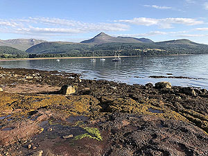
Across to Arran
Tap to Open
An additional short run on the island of Arran. Sunday mornings are generally a rest day or a nice short and interesting run and this is one of those.
A short run on Arran with the reward of some lovely views.
Glasgow half marathon
Tap to Open
The biggest half marathon in Scotland and a brilliant race to take part in. For a city half it is well supported and well organised. There are better halfs to do in Scotland, but this one should not be ignored.
21.1 Kms
in length and provides 116 m
of elevation. Road running in a point to point format.
Bennachie
Tap to Open
Bennachie stands proud in the Aberdeenshire countryside and can be seen for many miles around. This is a popular walking, running, cycling area so do not expect to be on your own for it. Worth the effort though.
11.62 Kms
in length and provides 494.95 m
of elevation. Trail running in a loop format.
Glen Loin Loop
Tap to Open
The Glen Loin loop is a cracker of a route and another we keep going back to. We have been spoilt with great weather when we do this one which is probably part of the reason we keep going back.
17.75 Kms
in length and provides 366 m
of elevation. Trail and dirt road running in a loop format.
Loch Skene
Tap to Open
Loch Skene is located on the west of Aberdeen just beyond the village of Westhill. This is a nice route and very flat so making it idea for gentle recovery runs or some speed work.
7.74 Kms
in length and provides 33 m
of elevation. Trail and road running in a out and back format.
Pitfitchie loop
Tap to Open
The Pitfitchie loop is one we generally do of an evening when working in the Aberdeen area. No idea why, but seems to suit the evening style of a run. Good quality forest roads.
16.72 Kms
in length and provides 404 m
of elevation. Trail and dirt road running in a out and back format.
Glen Sherup loop
Tap to Open
Another route in the Glen Devon area and this is a tough one taking in a few small summits along the way. A map is needed for this one as the trails can get very faint in parts. Very enjoyable run.
16.04 Kms
in length and provides 623.48 m
of elevation. Trail running in a loop format.
Firmounth
Tap to Open
The Firmounth route was a weekly run for us when we lived in the village of Aboyne in Aberdeenshire. We have done this route in all kinds of weather and any time we are in the area we do it again. Great route on good quality track.
18.94 Kms
in length and provides 547.38 m
of elevation. Trail running in a loop format.
Meikle Tap
Tap to Open
Meikle Tap is near Banchory though we approach this route from the road running past Echt. We have been lucky with this route as the weather has always been nice. A real good route with lovely views.
13.76 Kms
in length and provides 411.62 m
of elevation. Trail running in a out and back format.
Helensburgh - Glen Fruin
Tap to Open
As a child this is the place of the family picnic and full of great memories as we run through it. Lovely quiet road though once out to the Gareloch it does get busy.
27.41 Kms
in length and provides 416.87 m
of elevation. Country road running in a loop format.
Craigmore
Tap to Open
This is a wee cracker of a hill route where it is all up and then all down. Craigmore is the main hill sitting above Aberfoyle and one that is worth doing if you are short on time.
6.81 Kms
in length and provides 420.47 m
of elevation. Trail running in a out and back format.
Glen Almond
Tap to Open
This is an out and back we use when doing marathon training. Beware Glen Almond in the cold is very cold even with the sun shining. Perhaps we should try this one in the summer, but so far it has never happened like that.
32.2 Kms
in length and provides 354.22 m
of elevation. Trail running in a out and back format.
Glen Devon - Geordies wood
Tap to Open
Glen Devon - Geordies wood is a nice short route that packs in some hill just to make you work a little bit. We haven't done this one often and we should.
4.35 Kms
in length and provides 145.28 m
of elevation. Trail and road running in a loop format.
Aberfoyle to Loch Venachar
Tap to Open
This Aberfoyle to Loch Venachar is a mix of loops and out and back. Something different from Aberfoyle rather than the usual Loch Ard forest routes.
24.82 Kms
in length and provides 538 m
of elevation. Trail running in a loop format.
Loch Ard loop via Uamh Mhor
Tap to Open
Another
20 Kms
route from Aberfoyle and had become our Monday morning standard run before Covid-19 landed. Nice and varied route and we look forward to going back on future Monday mornings. 20.61 Kms
in length and provides 316 m
of elevation. Trail running in a loop format.
Queen Elizabeth forest park
Tap to Open
Queen Elizabeth forest park and one of the shorter runs that we have from Aberfoyle. This one has been done by us many, many times so can't be bad.
20.49 Kms
in length and provides 325 m
of elevation. Trail running in a loop format.
Glen Fruin to Loch Long
Tap to Open
Glen Fruin to Loch Long and feeling the love for the whole place as we return to our childhood haunts. Although mainly in trees the route does open out to give great views across the Gareloch and Loch Long.
21.32 Kms
in length and provides 664.48 m
of elevation. Trail and road running in a out and back format.
Strathyre and Loch Earn
Tap to Open
Strathyre and Loch Earn is a great route for getting in the miles for the longer races. This is mainly on tarred and hardcore paths but does have a section on the small lesser used road on Loch Earn's shores.
35.8 Kms
in length and provides 440.41 m
of elevation. Tarred and hardcore path and road running in a out and back format.
Dumyat hill run
Tap to Open
Dumyat hill run from Logie Kirk near Stirling is a short sharp up the hill kind of run. Highly recommened to be run as early in the morning as you can. Great views on a clear day.
7.45 Kms
in length and provides 394.59 m
of elevation. Trail and road running in a loop format.
Cocksburn reservoir loop
Tap to Open
From the LogieKirk near Stirling this is on quiet country road for the main part with a mixture of being out in the open and in amongst trees.
6.69 Kms
in length and provides 236.53 m
of elevation. Trail and road running in a loop format.
Kinnoull Hill
Tap to Open
Kinnoull Hill sits high above the city of Perth and boasts the old tower and great views. A short run and take some sort of map with you as there are paths everywhere.
8.54 Kms
in length and provides 284.03 m
of elevation. Trail running in a loop format.
Glen Finglas loop
Tap to Open
The Glen Finglas loop is a must do run if your fitness allows. This is one we keep going back to and have never been disapointed no matter the weather - apart from having to turn back once because of snow.
25.34 Kms
in length and provides 931.34 m
of elevation. Hill trail running in a loop format.
Loch Venachar loop (Lendrick)
Tap to Open
Loch Venachar loop from Lendrick visitor centre lets you start the loop towards the end of Loch Venachar. A mixed terrain route, but good quality all the way.
24.47 Kms
in length and provides 501.78 m
of elevation. Trail and road running in a loop format.
Loch Venachar loop
Tap to Open
Loch Venachar loop from Callander on varying surfaces and a good amount of climb. We have also covered this route from a starting point at the Lendrick visitor centre.
24.47 Kms
in length and provides 501.78 m
of elevation. Trail and road running in a loop format.
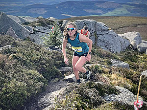
Ardgoil peninsula
Tap to Open
This Ardgoil peninsula route is brilliant but it is tough with over
1000 m
of climb over its 23 Kms
distance.This is one of those routes that seems to have everything though the first half is much better than the second.
23.1 Kms
in length and provides 1022.12 m
of elevation. Hill trail running in a loop format.
Ben Arthur - The Cobbler
Tap to Open
The Cobbler is a very popular hill walking route located beside Arrochar and is a real challenge to run. Mostly out and back with a small loop near the summit .
11.46 Kms
in length and provides 849 m
of elevation. Hill trail running in a loop format.
Loch Ard forest

Tap to Open
Another route in the series from Aberfoyle. The loop route is on mainly forest roads and is done as a large figure 8. One of our most popular runs giving you
416 m
of climb over the distance.27.46 Kms
in length and provides 416 m
of elevation. Hill trail running in a loop format.
Stob an Lochain
Tap to Open
In the right conditions this is a great hill run. There is
878 m
of climb in this and it is exposed once you clear the tree line so be warned. We have had to pull back from this route twice due to worsening weather. Great views.20.81 Kms
in length and provides 877.69 m
of elevation. Hill trail running in a loop format.
Lochs Voil and Doine

Tap to Open
An out and back from Strathyre that covers
38 Kms
in total so you can choose your distance. Nearly all on tarmac with a short distance on good quality dirt road. A nice route with few cars making it perfect for
training for the longer runs.38.1 Kms
in length and provides 569.88 m
of elevation. Country road running in a out and back format.
Clachnaben
Tap to Open
A hill run on one of the most prominent hills in south Aberdeeshire.
The route is just short of
16 Kms
and has a lot of climb in it.
Offers some stunning views over the Aberdeenshire countryside.
15.72 Kms
in length and provides 636.72 m
of elevation. Trail and dirt road running in a loop format.
Beinn an t-Sidhean
Tap to Open
This is a short and tough run due to the steepness of the hill,
but worth the effort.
It starts from the main Strathyre car park and a short easy section of less than
1 Kms
takes you to the start of the climb.
5.79 Kms
in length and provides 447.86 m
of elevation. Trail running in a out and back format.
Lochan Breaclaich from Killin
Tap to Open
A route with a good bit of climb and some varied surfaces. Most of this route is on good quality country roads, even the parts heading up the hill. There is one very boggy part that lasts about
2 Kms
which is a lot of fun.27.25 Kms
in length and provides 755.88 m
of elevation. Trail and road running in a loop format.
Ben Ledi
Tap to Open
Although hard, this run is real fun with the up to the summit draining you before the descent tries to put you on your backside. Every time so far we have fallen on that descent. Always however in a nice boggy, muddy, wet bit that hurts pride more than anything else.
10.06 Kms
in length and provides 804.32 m
of elevation. Trail and dirt road running in a loop format.
Scolty and more
Tap to Open
Scolty Hill near Banchory in Aberdeenshire offers a few hill climbs
along with distance added through an extended loop. Three main climbs exist on the route, Scolty hill itself plus an additional two
in the forest.
17.66 Kms
in length and provides 538.86 m
of elevation. Trail running in a loop format.
Ben Lomond
Tap to Open
Oh what a run this is if you can get the right weather and that's what happened for us and on our birthday. One of Scotland's iconic mountains and a bit of a running challenge.
12.1 Kms
in length and provides 774 m
of elevation. Trail running in a loop format.
The Glens
Tap to Open
A route from Lochearnhead taking in Glen Kendrum and Glen Ogle, to name just two of the glens. So far we haven't managed to do this run in sunshine, but this is a wonderful route to try.
24.52 Kms
in length and provides 539 m
of elevation. Trail running in a loop format.
The Fungle
Tap to Open
The classic route in Royal Deeside and the core of the Aboyne highland games hill race. One of our favourite runs. Not the longest of routes but a great challenge for anyone.
9.5 Kms
in length and provides 359.07 m
of elevation. Trail running in a loop format.
The races
Tap to Open
There are some wonderful races to take part in within Scotland and around the world. We have a separate page listing our selection along with data such as entry fees, travel, dates etc.
Open the races page by clicking on this news story.
Arran - Glen Rosa
Tap to Open
A short holiday took us to Arran for our first ever visit on this wonderful island.
11.87 Kms
in length and provides 181.19 m
of elevation. Trail and road running in a out and back format.
Helensburgh hill race
Tap to Open
Hill races during a highland games event tend to be tough and this one in Helensburgh is no exception. If you get a chance to take in the views they are wonderful, looking down the Clyde towards Arran.
This route is
8.31 Kms
along trail in a out and back format. There is 357 m
of climb along the route.
Harris half marathon
Tap to Open
Not the easiest of half marathon road races but one to put on your list as it is a wonderful route. Well worth the effort.
This route is
21.3 Kms
along country road in a point to point format. There is 332.4 m
of climb along the route.
Dearg up and doon
Tap to Open
The Dearg up and doon from Blair Castle is a new race from 2021 and is a cracker. Outsider Events also provide some shorter and longer distances.
This route is
31.62 Kms
along trail and dirt road in a loop format. There is 1027 m
of climb along the route.
Aboyne hill race
Tap to Open
At just over
11.3 Kms
the hill race at the Aboyne Highland Games is one of the classic races in Scotland. Brilliant route.
This race is
11.3 Kms
over mainly trail and forest road. Comes complete with 354 m
of climb split into two main sections of up.
Shettleston 10K
Tap to Open
The third and last race of the Babcock seriews usually takes place late May on a Sunday morning. The location if Glasgow green and along part of the river Clyde.
Nice and flat route though the final loop around Glasgow green can feel hard.
Dumbarton 10K
Tap to Open
The second race in the Babock 10K series is a popular Thursday night run in Dumbarton. Mostly flat with some easy inclines.
A well attended event with a start time usually at 7:30pm.
Killin 10K
Tap to Open
A lovely
10 Kms
in the heart of Scotland close to the foot of Loch Tay. Wonderful location and a very enjoyable route.
A 10K run by Tay Fitness so is well orgnaised. A small amount of elevation and good crowds.
Strathearn marathon
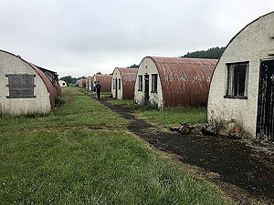
Tap to Open
The Strathearn marathon is located in central Scotland just outside of the town of Comrie. A bit of climb on this road race but where else can you start and finish at
a POW camp ? A real pleasure of a day spent on this one.
One of the friendliest Scottish marathons you can do.
Glencoe Marathon
Tap to Open
This marathon is really tough and is an absolute cracker of a race. Starting on Fort William and ending at the Glencoe mountain resort. You will be tired at the end of this and have a great big smile on your face.
42.2 Kms
in length and provides 1241.05 m
of elevation. Trail running in a point to point format.
Loch Katrine marathon
Tap to Open
Loch Katrine marathon is an out and back along the side of Loch Katrine where you spend most of the run looking at the views. There is undulating and there is undulating and this is very undulating.
42.2 Kms
in length and provides 452.7 m
of elevation. Country road running in a out and back format.
Helensburgh 10K
Tap to Open
Helensburgh 10K is us back in our old hometown and we generally try and make this one each year. Sometimes with family members. Friendly run and part of the Babcock series.
10.08 Kms
in length and provides 79.72 m
of elevation. Road running in a loop format.
Fort William Marathon
Tap to Open
Fort William Marathon has been discontinued but we hope it does come back. The last six miles of this race almost drowned us. Great route/race and please come back.
42.2 Kms
in length and provides 523.84 m
of elevation. Trail and road running in a loop format.
Hel N Back hill race
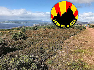
Tap to Open
Hel N Back hill race is in our old home town and we love this race to bits'n'back. This is tough, friendly and full of great food at the end. It is also on a Saturday morning which we rather like.
12.34 Kms
in length and provides 361 m
of elevation. Trail and road running in a loop format.
Lairig Grhu hill race
Tap to Open
The Lairig Grhu hill race has been for us our favourite race ever. We had glorious weather, ending up sunburnt, and really enjoyed the challenge. Not easy, even to get into.
43 Kms
in length and provides 727.76 m
of elevation. Trail and road running in a point to point format.
Mull half marathon
Tap to Open
The Mull half marathon is easy to get to for an island half and is a point to point race. The route is mainly along the coast towards Salem and has only
232 m
of climb. Maybe a lot for a half ?21.09 Kms
in length and provides 231.96 m
of elevation. Country road running in a point to point format.
Balloch to Clydebank half
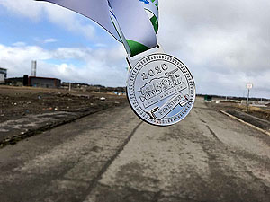
Tap to Open
In 2020 the Balloch to Clydebank took place shortly before the close down caused by the Corona virus. Good route, nice and flat and very well organised.
21.15 Kms
in length and provides 89 m
of elevation. Road running in a point to point format.
Barrathon
Tap to Open
2019 has been a great year for seeing some beautiful places in Scotland and Barra is most definitely one of them. The half marathon takes you right round the island and is one of the most friendly and welcoming races anywhere.
There is a fair bit of climb on this race.
21.09 Kms
in length and provides 283 m
of elevation. Road running in a loop format.
Skye half marathon
Tap to Open
Skye Half Marathon which is usually held in June.
This is a lovely race and perhaps our favourite ever half marathon. Not the easiest of runs as you do have some climbing to do, but it really is worth it.
21.1 Kms
in length and provides 257.83 m
of elevation. Trail and road running in a out and back format.
Loch Rannoch marathon
Tap to Open
Usually takes place in early to mid October.
This is a lovely run and a really friendly race to take part in. With a small loop round the village of Kinloch Rannoch to start with the race is mainly a run up one side of Loch Rannoch and down the other.
42.2 Kms
in length and provides 259 m
of elevation. Road running in a loop format.
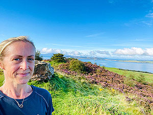
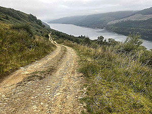
August pictures
Tap to Open
The last of the summer months and here is the picture set for the month of August. Colours on the hills are already starting to change by the end of the month so if you get the right weather your run can be visually stunning.
The August collection of images features images taken in August from around Scotland and elsewhere.
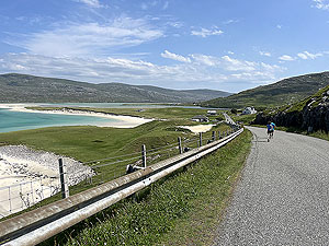
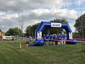
May pictures
Tap to Open
As Scotland moves into the month of May we start to see the first signs of the Scottish summer. May can be a mixed bag of weather, though May 2023 was very warm and sunny.
The May collection of images features images taken in May from around Scotland and elsewhere.
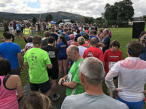
June pictures
Tap to Open
The picture set for June and the first real summerm month of the year. Don't take the weather for granted as like any other month anything can happen in Scotland.
June has some of the best races within Scotland including several on the islands.
The June collection of images features images taken in June from around Scotland and elsewhere.
July pictures
Tap to Open
The picture set for July and now in the middle of the Scottish summer. Beware of the mighty midges and all those other insects that bite or sting. Flying protien our friend calls them. Yuk.
It can get hot in July, so dont forget to check the forecast and bring sun cream.
The July collection of images features images taken in July from around Scotland and elsewhere.
April pictures
Tap to Open
The picture set for April and we are in the middle of spring and the clocks will have changed at the end of March. This means more light in the evenings
and some lovely running conditions. Oh and April showers of course.
The April collection of images features images taken in April from around Scotland and elsewhere.
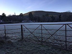
February pictures
Tap to Open
The picture set for February and a little more light is coming back into the running pictures. With February you never know what you are going
to get weather wise and that can only be a good thing. We think.
The February collection of images features images taken in February from around Scotland.
January pictures
Tap to Open
The picture set for January shows that it is worth getting out there for a run. There are some stunning views to be had along
some of our documented routes. Our favourite has to be the Glen Finglas loop but there are some crackers.
The January collection of images features images taken in January from around Scotland.
December pictures
Tap to Open
The picture set for December highlights the fact that we haven't taken many pictures for whatever reason. That said
there are some very nice pictures here and higlights the low sun of winter.
The December collection of images features images taken in December from around Scotland and beyond.
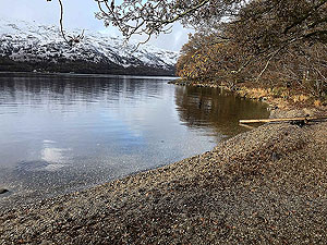
November pictures
Tap to Open
The picture set for November shows the start of the cold weather in Scotland with some snow to be found. However, some wonderful runs
can be had with spectacular scenery.
The November collection of images features images taken in November from around Scotland and beyond.
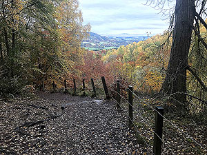
October pictures
Tap to Open
The completion of the October set of pictures marks the end end of our journey to cover all the months of the year with running images. Better still, these are all in the database making updates so much easier.
The October collection of images features images taken in October from around Scotland and beyond.
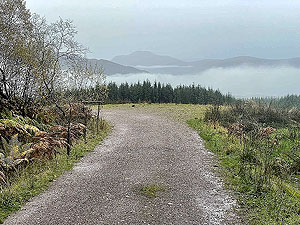
September pictures
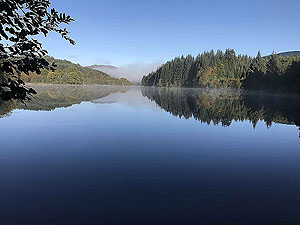
Tap to Open
Another picture gallery created to highlight running in a particular month. This time it is September and we have several pictures of mirror like lochs.
A collection of pictures from our gallery taken while running in the month of September.